Tag Archives: Lots Road Power Station

Figg’s World’s End

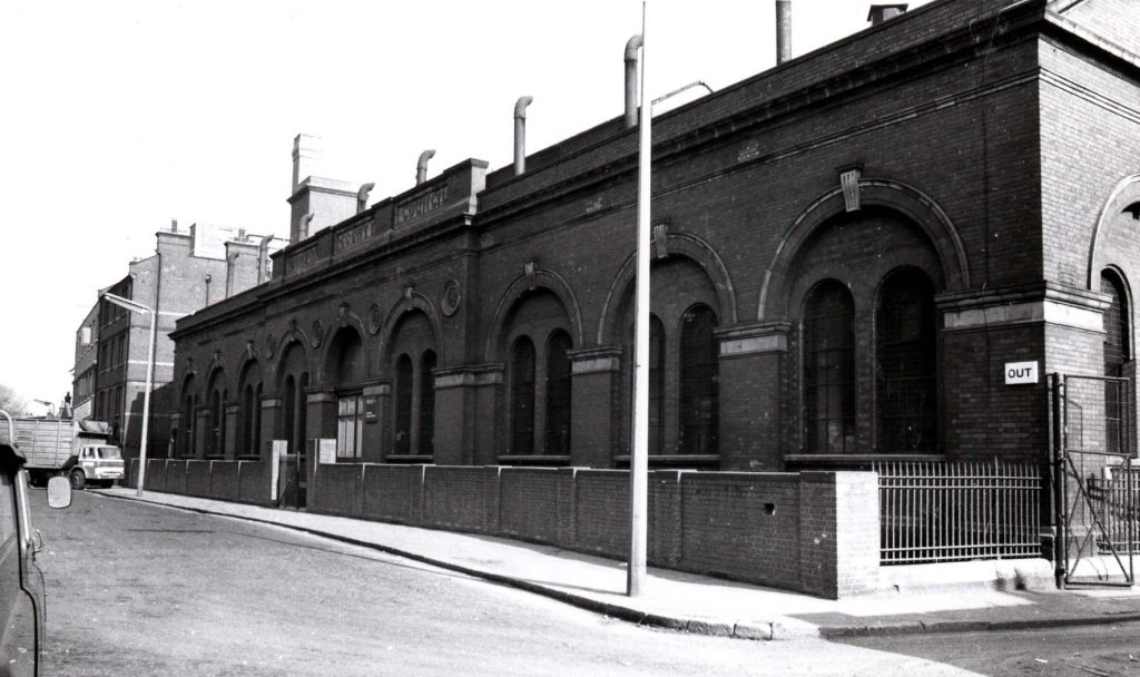
Like Bernard Selwyn (see this post among several others), our other chronicler of Chelsea (and other places), JW (Bill) Figg took his camera to work, and the locations he visited gave him access to some unusual perspectives. We’ve already seen his pictures of the interior of Lots Road Power Station. This week we’re following him onto the roof.


In this picture (he’s looking north east I think) across the streets of terraced houses near the Station towards the World’s End Estate.  I suspect this is about 1977. Here he zooms in a little.


The estate wasn’t the only thing he could see from his vantage point. Here, he looks down at the river and some of the buildings on the bank.


Note that single car parked right at the end of the jetty. (Why drive all the way to the end?)  The short section of ramp puzzled me for a while because I was sure someone had told me exactly what it was in a comment on another post. And they had. Here’s a link to the post and a thank you to Roger Morgan.

Below , the view also takes in both Battersea and Albert Bridges, with Battersea power station in the distance.


Coming down from his vantage point, Figg also took pictures from the other side.

On a far more sunny day, the World’s End Estate from the south, including the houseboats at Chelsea Reach and in the background the Cremorne Estate.


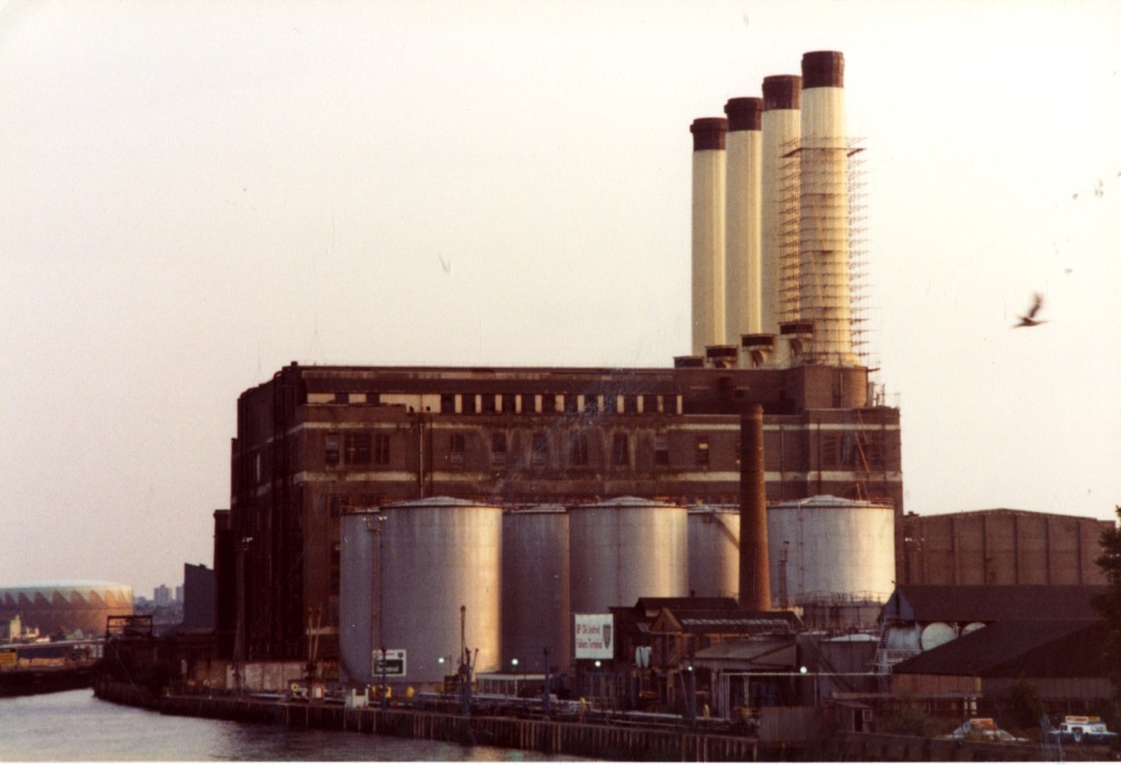
Below, the Wharf buildings, including what must be the two chimney version of the power station, with the furthest chimney hidden by the angle of the shot.


The water looks deceptively calm and pleasant.

This tranquil view across the river as it curves around the bend towards Wandsworth and Putney shows the railway bridge and the completed Chelsea Harbour development.


These pictures date from the 1990s, but Figg had been keeping an eye on the development for a while.


He must be back on the roof of the power station for the next series of images. He dates this one (and presumably the others) 1989.

This section was just a muddy hole with a temporary car park at this stage.


The buildings soon emerged from the mud.


I’m not entirely sure what this one is. I’m sure someone can tell me.


Here you see the overall structure taking shape as the development grows.


The completed Harbour seemed a remarkably optimistic piece of work when it sat there on its own at the end of the increasingly gentrified Lots Road, but since the tide of development has moved along Townmead Road through Imperial Wharf, with new housing and retail development, and a new railway station it looks like the first outpost of a new urban riverside strip heading towards Wandsworth Bridge, with similar developments on the south side of the river.

Figg is still on his perch when he looks north again.


In the distance, Chelsea Football Stadium. Immediately below, I’m tentatively identifying the street as Tettcott Road. Follow its path past the ramshackle adventure playground to the blue building which I think is the Fyna Works, which was pictured at the end of a previous Figg post.

When you read the title, Figg’s World’s End, I imagine you thought it would involve images like this one.


A rare colour view looking up Dartrey Road, one of the lost streets of the World’s End at the King’s Road. Or this view of St John’s Church.


We have seen picture like that before, but this one  is a bit of an scoop.


This shows the power station looking across the cleared streets where the World’s End Estate was built. A unique image in our collection.

Finally, one for World’s End enthusiasts like friend of the blog Mr Chris Pain.


I’m pretty sure this is a view of a surviving World’s End building from the opposite direction to the preceding picture. Can anyone identify it and say exactly where it was? A friend of mine came into Local Studies this afternoon as I was finishing up and suggested it might be an antiques shop on the King’s Road but some close work on Google Street View makes me doubtful. Any suggestions?

Postscript

Thanks to all the people who left comments on last weeks post, especially the identification of the cars, and about of the eastern end of Kensal Road. You all add immeasurably to the character of the blog, and its usefulness as a source of information. We’re enjoying a bit of a surge in page views at the moment  (post-Christmas energy?) so welcome to anyone who’s just started reading. There are plenty of links this week to take you back to older parts of the blog.

Another postscript

I haven’t done any death notices for a while but I must note the passing of Peter Wyngarde announced this morning. My first reaction was surprise that he hadn’t died years ago, which is a bit mean but it is a common phenomenon. I was a fan of all those ATV shows in my teens, not just Department S but also the Champions, Randall and Hopkirk, the Baron etc. I can also admit to turning back my shirt cuffs over the cuffs of my jacket (yellow shirt, black jacket – it was the 70s) on at least one occasion and having a younger boy from next door shout “Jason King” at me. TV aficionados will also remember Wyngarde in that Hellfire Club episode of the Avengers (despite the memory of what Diana Rigg wore in that episode). I actually met Wyngarde on a couple of occasions when he came into the library, usually to borrow the text of a play. He died at the Chelsea-Westminster Hospital so perhaps he remained a local boy. Thank you, Peter.


Lots Road Power Station: a look inside – 1977

A new tower is rising close to the remaining chimneys of Lots Road Power Station with a sign on it saying Chelsea Waterfront. The station building itself is more or less intact but empty inside. It stopped being used to provide electricity for the tube network in 1985 but was kept as a back up until finally closed in 2002. Since then various schemes have been proposed for its future use.

The pictures in this week’s post which come from a collection recently acquired by the library take us back to what it looked when it was still a working power station.

Chelsea residents and visitors are used to the view from Lots Road .


In the late 1970s steam still rose from the chimneys as in this view from the southern bank of the river.


I’ve written a couple of posts about the station before, concerned with the matter of its chimneys, and its days as an industrial icon. Those posts were quite popular so I’m quite confident about today’s views. Regular readers will know that I like industrial pictures. After a string quartet of Edwardian/Victorian  ladies in postcard and book illustrations so many times it’s a refreshing change to savour some (literally) heavy metal, whether at the gas works or the water works although the appropriate music for this era and setting is of course Kraftwerk.

There is something awesome about large complex pieces of machinery, especially when they are used to generate power.


The photographer had the chance to roam high and low in the enormous space, above massive pipes and turbines.


All controlled by huge, complex but somehow retro control panel.


Gantries and platforms.


Light streaming in from the huge windows at the end of the hall. Even though it’s a cliché, I can’t leave out the words cathedral of power.

The designers came from an age when industrial shock and awe was something a building could aspire to have.


And this white coated man in the control room could be described as an acolyte, if we’re in that sort of mood.


This picture shows the sheer size of the space and the lighting needed to illuminate the rows of generators.


This view looking down shows the tangled layers of plant and machinery with manual controls visible on one of the platforms.


Below a favourite kind of view for me, the network of stanchions – compare it with something similar at the much smaller Alpha Place  generating station.


Below, part of a wall-mounted diagram explaining the whole thing for engineers and other interested parties


This picture taken near the roof of the station shows the interior section of one of the chimneys


Back again to ground level it’s 10.45.  AM or PM? I can’t say.


Lastly, one of the controllers takes a break, relaxing at the heart of this giant piece of machinery, some kind of hum, loud or small, around him, but probably not the sounds of electronic music. You can imagine that


Postscript

See more on the area around the station in this post. Watch out in the future for a few pictures of the construction of Chelsea Harbour


Griffen of Chelsea: fragments from an artist’s studio

It was back in 2012 that I used a picture of Lots Road Power Station by Alfred Francis Griffen in a post and promised you would see more of the artist in the future. I’m finally making good on that promise. While I was scanning these images I googled Griffen to see if there was anything else about him out there, and all I found was my own post. So let’s see if we can shed some more light on an apparently almost forgotten artist.

The Library has a small collection of work by Griffen, mostly sketches in pencil, ink and water colours with a few etchings and some finished works. These were donated to the Library by his widow in 1955. She must have known that even his sketches and unfinished work would be of interest in the future. There is enough of this material to show that he was a skilled artist with an lively eye for detail and atmosphere.

Griffen - Gas works in Chelsea 1935 2nd composition B2088 back of envelope

Griffen’s work is almost unique in our collection because of his interest in the back streets and industrial settings of the western end of Chelsea, where he lived and worked. This sketch shows his ability to capture the action in a quiet street and the attention to detail which characterises his work. Do you see  the man on the left defying superstition by walking under a ladder? Here are two versions of the same etching:

Griffen - Chelsea Railway Staion nov 14 1950 trial proof 2085

“Chelsea Railway Station November 1950” – This may be the station near the Chelsea Football ground which was closed in 1940. Some of the station buildings may have survived as long as 1950.

Griffen - Chelsea Railway Stationjan 16 1951 3rd state suggested improvements 2087A

He has marked the areas where he has made changes. Some more shading of the figures of the entwined couple has brought them to life. Underneath he has written “with suggested improvements in figures” in the same red ink.

Half-finished sketches give some idea of how he created pictures.

Griffen - Drawing mar 28 1959 2097A


The contrast between the careful ink work on the finished part and the pencillled section is fascinating in this view of Milmans Street. (I think it says Milman anyway)

He tried several times to get the view below right:

Copy (2) of Griffen - view frm Bagley's End July 1944  2080A

Copy of Griffen - view frm Bagley's End July 1944  2080A


Finshed pictures show that all the careful sketching paid off whether the result was monochrome as in this drawing.

Griffen - March sunshine in Kings Road mar 26 1949 2097S price 12-6

Or fully coloured as in this view of Chelsea Old Church after it was bombed in 1941.

Griffen - The ruins of Chelsea Old Church May 1941 2075B

Griffen could also do the pretty houses and familiar views of Chelsea as in this watercolour of Lindsey House:

Griffen - Lindsey House 1919-20 B2696

But I think his most personal material is about labour and industry.

Griffen - Dredger at work on Thames 1938 B2073

A dredger at work on the Thames.

Griffen - From Battersea Bridge Aug 1938

Another view of Lots Road Power Station, from Battersea Bridge. Many of the skecthes are on the back of scrap paper, envelopes and forms he had probably retrieved from work. But on the back of that picture I found a rough sketch of a woman

Griffen - Drawing of a woman rear of 2069B

She looks smartly dressed as if she was going to appear in one of his views of  Sloane Square, or Albert Bridge like this colour sketch for a drawing eventually completed in pencil.

Griffen -Study for a black and white drawing of Albert Bridge oct 9 1938 2095A

Or this picture, probably the best of his work in our collection.

Griffen Fulham Road 1946

Fulham Road, at the Queen’s Elm, 1946. The war is over, the lights are back on. A disabled man and his wife cross the road. A woman in a fur jacket with three children crosses the other way The buses are running, fully illuminated. In the far distance the tower of St Stephen’s Hospital. I know this spot well from the brighter end of the century. Griffen has caught the smoky atmosphere of early evening in a city recovering from war. I think our friend Yoshio Markino would have recognized this scene.

Postscript

I haven’t completely exhausted our collection of Griffen pictures if you’re interested in seeing more. I don’t have a great deal of biographical information on him although I know some people have collected his work. He lived quietly in a flat in Gertrude Street, Chelsea with his wife Edith from 1935 until his death in 1955. Their surname was mispelled as Griffin in the electoral register in the pre-war years. Some years ago a gentleman sent us some greetings cards with Griffen pictures of other parts of London, which I have kept hoping that someday I would be able to use them, as I may in a later post.

When I describe an artist as almost forgotten I expect that several people will come forward and say: “No, we know all about him, he’s highly thought of in some circles and you can see more of his work at…….”

Here’s hoping.


On the border: Lots Road before the Harbour 1983

We’re back on the edge of Kensington and Chelsea this week looking across two bodies of water, one large, one small, at the neighbouring territories of Fulham and Battersea. These photographs come from the same source as the ones in the Paddington post, but date from 1983, when the right angle bend of Lots Road was a backwater and the semi-abandoned railway land on the other side of Chelsea Creek was an industrial wasteland, a brown field site if ever there was one.

Lots Road 03 Jul 1983 017

This territory would become the ambitious and prestigious Chelsea Harbour development in a few short years but when these picture were taken it was still a remnant of the days when the Creek was lined with wharves where barges of raw materials were unloaded. Trains were marshaled in the many sidings and on the Fulham side there were warehouses and factories.

Lots Road 03 Jul 1983 006

Fulham Power Station is on the edge of this pictures, Lots Road ‘s younger brother often mistaken for its older sibling. The difference is clear though.

Lots Road 03 Jul 1983 025 col

The concrete chimneys are in a line at one end of the building. A power station had been built on the site in 1901 but this is the B Station constructed in 1936 and decommissioned in 1978, five years before these pictures were taken. After some controversy over asbestos removal it was partially demolished with the remainder being converted into a storage facility.

The two stations were separated by the railway lines. The photographer, Bernard Selwyn, was a surveyor who had access to the railway bridge from which this picture was taken.

Lots Road 03 Jul 1983 010

The gasometers in the background are in Fulham.

This view is directly west looking up the river. It looks quite different these days with mostly residential developments on both sides of the river up to Wandsworth Bridge and beyond.

Lots Road 03 Jul 1983 024 col

But that’s way out of my territory. Here is the view looking north into Chelsea

Lots Road 03 Jul 1983 012

You can just make out the Balloon Tavern in the distance. The  white building next to it in the picture still exists as well.

This is a closer view.

Lots Road 03 Jul 1983 018

The towers of the World’s End Estate appear in the background of every view in that direction.

The gantry also dominates this picture

Lots Road 03 Jul 1983 014

Chelsea Creek is just behind that wall not quite visible in this picture. A body of water, some hundred year old brickwork, an enigmatic metal structure, industrial buildings with an air of abandonment, grass growing uncontrolled around them. All elements of a certain kind of post industrial landscape.

Lots Road 03 Jul 1983 019

But don’t get me started on the beauty of industrial decay. We could be here all day admiring the desolation.


Lots Road 03 Jul 1983 011

There are cars in this pile of discarded metal.

Lots Road 03 Jul 1983 001

The river looks quite unfriendly and forbidding in this picture showing how close all this empty space was to the highly populous estate.

Lots Road 03 Jul 1983 002 - Copy

Across the river in Battersea is St Mary’s Church, where William Blake was married, On either side of it are two buildings now replaced. Where the flour mill was is now the Montevetro building. The Old Swan Tavern is also a residential block, though much smaller as you can (just about) see in this photo I took last year.

DSC_2527

Is the pleasure cruiser in the picture below the same as the one seen passing by the church.?

Lots Road 03 Jul 1983 015

It seems to be heading towards the centre spans of Battersea Bridge.In the centre of the picture is the far off BT Tower, but take a close look and you can make out Chelsea Old Church. The cylindrical building on the left is the Sheraton Park Tower in Knightsbridge, but I’m open to suggestions on the other two towers.

Not quite finally, a view of our still surviving friend the Lots Road Power Station from the railway bridge.

Lots Road 03 Jul 1983 009

The derelict space would soon be filled by the Chelsea Harbour development and all the subsequent riverside growth, not long after Selwyn took his pictures. In 2013 it  looked like this:

DSC_2493

So this is the lost borderland between Chelsea and Fulham, and this was the house on the borderland:

Lots Road 03 Jul 1983 004

In this one it looks most like the giant of its glory days but sleeping now. It has proved to be a persistent building surviving all the development around it.

Postscript

The photographs are by Bernard Selwyn part of a collection of material bequeathed to the Library by him. The two 2013 pictures were taken by me last summer when I went out to take pictures for another post.

After last week’s post I was reminded that the Chelsea Harbour area was fictionalized as Chelsea Marina by J G Ballard in Millennium People.


More Markino: water and women

And then, as the Japanese smiled unperceived at me, and rolled a cigarette, the superb Wilton turned himself a little on the sofa, rearranged a cushion beneath his elbow, and began a long half-intoned speech about newspapers, the folly of reading them, the inconceivable idiocy of those who write for them, and so forth, while I agreed with him at every point, and the Japanese, who knew it by means of livelihood chuckled quietly to himself…

Wilton must have enjoyed that afternoon. He thought he had a proselyte in me, and he talked like a prophet, till I wondered how it could be possible for any one man’s brain to invent such flood of nonsense. I was happy under it all if only on account of the quiet quizzical smile of the Japanese, who was making a sketch of the orator’s face…

The Japanese excused himself from accompanying us, and went down to the river to make studies for some painting upon which he was engaged…

Arthur Ransome – Bohemia in London (1907)

Electric power works Chelsea COL (2)

Ransome’s Japanese artist with the quizzical smile was Yoshio Markino and he did like to walk by the river, starting in Chelsea but sometimes walking through the whole night.

A winter afternoon Chelsea Embankment COL - Copy

Below, the water runs swiftly past the piers of Albert Bridge.

The running tide Albert Bridge Chelsea Embankment COL (2)

A monochrome view of the same bridge.

Early evening Chelsea Bridge COL - Copy

This water level view was one he was particularly liked. Here is another version a good walking distance away:

Copy of Tower Bridge COL

An even longer walk , or even a train journey in the other direction, past the tidal river:Punting on the Thames - JB - Copy

Punting on the Thames. This picture combines Markino’s love of water, mist and dusk with the other thing he loved most about London, English women. One of the books Markino wrote was the eccentrically (and ungrammatically) titled “My idealed John Bullesses” (1912). In the introduction he apologises for his “home-made English” and admits to having been fascinated by European women since the age of six when his father brought home a chromo-lithograph picture of a young woman. “It seemed to me that this girl was always beckoning me; whenever I looked at it from distance and I always went under the picture and bowed down to pay my homage to her.”

“The quiet and deep blue stream of Thames is very beautiful, and it looks more beautiful when it runs round the green ground with many graceful trees. But these beautiful views could not be so beautiful if the John Bullesses did not visit there. Their dresses in white, pink, and all sorts of light colours break the monotonous greens on the shore as well as in boats, and give some delightful contrast. And when the dusk comes they look still prettier. Have you ever seen the religious picture of Buddhism ? Buddhas and all saints are always sitting on lotus flowers or on its leaves. The idea was to give some nice and cool feeling in such a hot country like India. If I have to paint a picture to give a nice and cool feeling I should paint a John Bulless punting a boat on the Upper Thames. John Bullesses in boats or John Bullesses on the green are the most important element to complete the beauty of the Upper Thames.”

It’s a strange book for the modern reader, half archaic and half modern. Markino was a great supporter of the Suffragette movement – there are chapters on the WSPU and the Suffragette  procession of June 1911. Others deal with his  fascination with fashion, shopping and social life.

Markino observed the women of London wherever he went, at night at the theatre:

Copy of Leaving His Majesty's Theatre the Strand COL

And during the day, in small groups:

Fog - Ladies crossing Piccadilly COL (2)

And in larger gatherings.

A party of tourists before St Paul's Cathedral COL - Copy

These two are set in Hyde Park. This one is of what he calls the Church Parade on a June Sunday:

Copy of A June Sunday - church parade in Hyde Park COL

This is the morning parade on Rotten Row:

Copy of Morning Parade in Rotten Row COL

As good as his daytime pictures are, Markino always returned to the gloom.

Copy of Christmas shopping Regent Street COL

“I often recollect some Japanese insect called ” Mino Mushi,” or ” Overcoat Insect.” This small insect gathers feathers, dead leaves, bark, and everything, and ties them up together with her silky webs, and wears this heavy overcoat. But when she takes off that overcoat, lo, she is a beautiful butterfly. Some John Bullesses bury themselves into such thick fur overcoats in winter. You can hardly see their eyes ; all other parts are covered with foxes’ tails, minks’ heads, seal’s back skin, a whole bird, snake’s skin, etc. etc. They make their size twice or three times larger. But when they get into a house and take off all those heavy wearings, such a light and charming butterfly comes out.”

Outside St George's Hospital - JAIL (2)

…my work is not yet completed. But we say in Japan “That which you like most that you can do best.” Having trust in this proverb I have decided to spend the rest of my life here to study dear London all my life.”

Markino reluctantly embarked on a repatriation boat in 1942. He was never able to return.

Tombstone design - Copy

Tombstone designed by Markino.

The pictures:

Electric power works Chelsea

A winter afternoon Chelsea Embankment

The running tide Albert Bridge

Early evening Chelsea (Albert) Bridge

Tower Bridge

Punting on the Thames

A party of tourists before St Paul’s Cathedral

Leaving His Majesty’s Theatre the Strand

Fog – Ladies crossing Piccadilly

A June Sunday – Church parade in Hyde Park

Morning parade in Rotten Row

Christmas shopping Regents Street

Outside St George’s Hospital

Quotations from the Colour of London and My idealed John Bullesses.

Postscript

It was a close run thing tonight so apologies for any typos or spelling errors. I spent the afternoon following an architect round the all the little rooms of the library sub-basement which will soon become a smaller number of larger rooms.


100th post: Bignell meets Hedderly

100 is a special number so it deserves a special post.  I can’t actually arrange a time travelling meeting between the two Chelsea photographers John Bignell and James Hedderly but I can bring them together in another way.

John Bignell was not only a photographer but a student of photographic history. He wrote a visual history of Chelsea, “Chelsea seen from its earliest days” (1987). And he owned a collection of Hedderly photographs. On one occasion as you’ll see he recreated a Hedderly picture. But as a Chelsea photographer he literally went over the same ground as Hedderly and you can see echoes of his predessessor , conscious or unconscious, in his work.

Here’s an example. In the picture below Hedderly is looking east along Cheyne Walk in the pre-embankment days. The road is roughly paved and narrow. The wooden fence on the right marks the river’s  bank. On the left you can just see the edge of the King’s Head and Eight Bells public house. The image has faded over the years so the white misty background beyond the trees may be deceptive. It will have gotten more mysterious as the print has aged so we may have lost some detail but you can get the quiet atmosphere of riverside Chelsea in the 1860s.

001 Hedderly - H36 Cheyne Walk by King's Head

Nearly a century or so later in 1950 Bignell took this picture.

001 Bignell - Kings Head and Six Bells 1950 1840A

The foliage is lusher, there’s a garden on the right beyond which is a very much wider Cheyne Walk. The buildings in the background have changed with the exception of that one with the ornamental porch. The lampost looks very similar too although it may have been replaced with one which looked the same. You see a little more of the pub. And of course there is a small crowd of pub-goers who have spilled out of the bar onto the street. The men look about as casual as Chelsea  men got in 1950, the women slightly more so. In contrast to the 1860s picture only a couple of them are paying the slightest attention to the photographer. I wonder if the man in the double-breasted jacket is bringing a drink for Bignell.

The two pictures fit together remarkably well. This is not so obvious in the next pair.

003 Hedderly St Lukes

This is one of Hedderly’s rare north of the King’s Road pictures, possibly a commission. It shows the “new church” St Luke’s in Sydney Street. The church would have been thirty or so years old in this picture. The churchyard to the left looks well populated.  But the church, surrounded by trees, is still in a suburban setting.

The view by Bignell shows the urban setting of the late 1950s.

003 Bignell - St Luke's Church JB5 box

The trees are still there but London has caught up with the church and surrounded it. In the background you can see one of the domes of South Kensington. In the foreground however is another building Heddderly would have seen at some point in his life, the Chelsea Workhouse. It wasn’t a workhouse in Bignell’s day but you can see the forbidding nature of the place.

Both photographers were fond of riverside views.

002 Hedderly - H01 boats - bridge in background

I’ve featured Hedderly’s pictures of Chelsea Reach and the area by the Greaves boatyard in another post. This is an image I’ve never used before. You can tell the direction of the picture from the just visible view  of old Battersea Bridge in the distance.

002 Bignell Chelsea Reach 1965

Bignell’s 1965 view shows the current Battersea Bridge being crossed by four buses. The suspension towers of Albert Bridge can also be seen, with Battersea Power station in the distance, a couple of the chimneys visibly smoking.  The crucial difference in the hundred years between the pictures is the use being made of Chelsea Reach. The sailing barges are gone, replaced by houseboats, and the men at work have been supplanted by a pair of daredevils playing around on a nearly sunken barge at high tide. It probably looks more dangerous than it was. Bignell is certainly standing by quietly with his camera, apparently unconcerned. But their mothers wouldn’t have been too happy.

This image is one of Hedderly’s best photographs:

004 Hedderly CM1003 Trees of Cremorne

This is a view taken from the tower of Chelsea Old Church. It shows the tangle of closely-packed houses and wharves between Cheyne Walk and Beaufort Street before the embankment. Beyond are the larger house of Lindsey Row and the trees of Cremorne Gardens. Bignell owned a print of this picture and made an enlargement of it. I was examining it this morning imagining myself walking along Lombard Street towards Johnson’s Coal Office and then into Duke Street past the Adam and Eve Tavern. You could cross Beaufort Street and walk along the riverside to the wharf at Cremorne where the boats brought pleasure seekers to the Gardens all the way from London. Is one of those buildings visible in the distance Ashburnham House?

Bignell was so fascinated by this picture that in 1978 he too climbed the tower of Chelsea Old Church (though not of course the same tower, but a meticulously restored copy of the one Hedderly climbed) and took his own picture.

004 Bignell - Chelsea Riverside JB335

From this vantage point Bignell saw the sunken garden named after Sir Thomas More’s daughter Margaret Roper, the four lanes of Cheyne Walk which now pass right through where the old houses and taverns stood, and part of the old river too. He saw Crosby Hall, transplanted from the City in the1920s and where the pleasure gardens were, the towers of the World’s End Estate. You could barely make out the industrial landscape beyond the gardens in the 1860s picture, just a few chimneys. In 1978 Lots Road Power Station was still generating power and still had two of its chimneys.

Hedderly took a companion picture from the Church which he joined to the first to make a panoramic view. This is  part of it:

005 Hedderly Old Battersea Bridge

Almost the whole length of the old bridge, and the industrial zone on the Battersea side of the river.  Bignell didn’t try to get the whole view in again but his second shot takes in more of the bridge and the area west of the Power Station. Lots Road’s younger cousin Fulham Power Station with its four in line chimneys is on the left of the picture.005 Bignell - Chelsea Reach late 60s jb334

Bignell had a great reverence for Hedderly’s work and must have felt a connection between them. It’s unlikely that James Hedderly ever imagined the possiblity of that link or realised the great attention which would be paid to his work in the future. What would he have said or thought if he could have seen Bignell’s work and glimpsed some of the sights he would see and the technical possiblities that were to come?

Bignell - Albert Bridge at night 1951

[Night view of Albert Bridge 1951]

Postscript

The 100th post on the Library Time Machine, a point I must have thought was possible when I started but I couldn’t have imagined how I would get here. The answer of course is just find some pictures every week and write something about them. Sometimes the ideas run three or four posts ahead, sometimes they stretch no further than next week (or less on a few occasions).

The other thing I imagined was that I would run out of ideas. It’s true that a lot of the big topics have been covered but only a few of them have been done so thoroughly that I could never go back there again. So we might visit Cremorne Gardens again one of these days or take another look at Marianne Rush or William Burgess. There are even a few unseen Linley Sambourne pictures knocking about on the hard drive. And judging by the continuing popularity of the Duchess of Devonshire’s Costume Ball we’ll almost certainly be going there again . I’ve probably done all I could on Walmer Road and Hurstway Street but there are plenty of other streets to walk down in the past and the present. One or two artists you haven’t seen yet. And yet more forgotten buildings and secret places. So all other things being equal it is just about possible that we might get as far as 200 posts in another eighteen months.

The conclusion is that there really is no end to history even in a small (but significant) part of one city, in one country, on one world.


Lots Road 1972: the L-shaped street

Lots Road is that rarest of street configurations, an L-shape so it has a north side, a south side an east side and a west side. So where do we begin? Here?Lots Rd (rear of) W side looking S Chelsea Creek 1972 KS 4029

This is the view looking south from Stanley Bridge, just to the west of the junction with the King’s Road and right on the border of Kensington and Chelsea. The rail line which was constructed on top of the filled in section of the Kensington Canal is on the right but it looks as though a small section of this part of the creek survived.

But let’s not go that way. What about starting at the other end?

Lots Rd looking W 1972 KS 4056

That’s the junction with Cremorne Road. The Power Station is visible with two of its chimneys intact. On the right, a small corner shop. There were still plenty of those left in 1972, the year John Rogers took these pictures for the Library. Another summer day at the tail end of the long 60s.

Lots Rd N side corner with Cremorne Rd 1972 KS 4053

Just as in Hurstway Street a few years before Tizer is still popular. Above the door is a lager advert featuring Henry VIII and one of his wives, uneasily drinking a pint of Harp under the motto Keep a cool head. I must have drunk Harp, one of those generic British lagers but I can’t remember the taste, if any.

The north side of the street was destined to survive in the face of redevelopment but came perilously close to meeting the fate of Bifron Street, Raasay Street and the rest. A little way down the road you can see one of the towers of the World’s End Estate rising. In 1972 it would become the largest council estate in Europe.

Lots Rd N side 12 1972 KS 4051

It’s often assumed now that the large housing developments of this period were a bad thing. It’s certainly true that the houses in the World’s End which were demolished at this time would probably have been gentrified had they survived and would now look pretty good. But almost none of them would be in use as social housing. I’ll do a post on the construction of the estate one of these days.

The south side of the street was occupied largely by commercial buildings of one kind or another.

Lots Rd S side 9-7 1972 KIS 4048

The easternmost part of Chelsea had been an industrial zone since the latter half of the nineteenth century. Even when the high and the low were at play in Cremorne Gardens, raw materials were being landed and unloaded at the various wharves on the river and on Chelsea Creek which continued north as the Kensington Canal, a never quite profitable venture created by the then Lord Kensington. Lots Road the former Poole’s Lane followed the  line of the canal northwards to the King’s Road hence the L shape. The wharves were still in use in 1972.

Lots Rd S side Chelsea Wharf W 1972 KS4054

Note the  cobbled surface redolent of the 19th century even  clearer in the picture below.

Lots Rd S side Chelsea Wharfe 1972 KS 4055

Behind the crane you can see the south side of the river. Just visible above the head of the man on the right is St Mary’s Church which has been a significant landmark in images of the south bank foe more than a century. I think I’m right in saying that all the other building visible on the south side of the river are now gone. (I should apologise for any inadvertent inaccuracies in this post by the way. I know that many people know the history of this bit of Chelsea far better than me. I meant to have a walk along Lots Road before writing this but couldn’t quite find the time. However it looks as though at this pace this post is going to end up as a two-parter so I may have time for some field work yet)

Here’s another view looking south:

Lots Rd S side Chelsea Wharfe 1972 KS 4052

This shows the warehouse across the river in better detail but as you can also see there are two churches visible so it’s possible the one in the previous picture was not St Mary’s. Comments are welcome on this point and any other details in the pictures.

ng Stn 1972 KS 4046

Some of the Wharf buildings have been redeveloped but the Pumping Station has survived as has the building below (although it has been seriously modernised) :

Lots Rd S side Frenlite Hse 1972  KS 4049

For me what makes this picture fascinating is the two pigeons strolling into view from the right. It may have been a quiet moment of the day but in many of the pictures from this period you see a quieter version of London where lazy birds can walk in the street without being disturbed.

A man can also wheel a barrow down the street.

Lots Rd S side 1972 KS 4042

The large windows in the foreground belong to the Power Station. Unlike its more famous counterpart in Battersea, Lots road Power Station is right on the street where you could walk by and glimpse the massive machinery within.

Further west we reach the end of the east to west section of the road.

Lots Rd S-side 1972 KS 4038

Another view of the ranks of tall windows.

It does look as though we will have to pause here with a view of one of the famous pubs of Chelsea.

Lots Rd E side 114 Balloon Tavern 1972 KS 4019

The Balloon has gone under a few names including one very long version when it was part of the Firkin chain of real ale pubs. How did that name go? Oh yes, “The Ferret and Firkin in the balloon up the creek”, which had definite local connotations.

If I do manage to walk down Lots road before next week I’ll take some pictures, but if anyone has any modern ones of their own they’d like to share feel free to send them to me at dave.walker@rbkc.gov.uk or post them in the comments section.


Lots Road Power Station: the glory years

Sombre and majestic, four monstrous towers rise through a blue haze. The lights of the loading yard and the ancillary buildings shine through the evening gloom. Those who had feared the forbidding structure later came to see it as a huge gothic folly looming over the dark waters. And the giant was beneficent, giving power to that network of tunnels and tracks which carried the people of the city from home to work and back again.

Or that’s how it was seen by Londoners in the years before the Second World War. London Transport was proud of the great beast crouched by the river and the task it performed.

Inside, operators attended to the creature’s need like priests attending to a captive deity in a temple. Lots Road Power Station or Power House as it was often called was one of those big engineering feats which belong to the early years of the 20th century such as the Titanic. Unlike the Titanic, the Power House never failed its people.

This view from the river shows its cathedral-like windows. In daytime this was no dark tower. Light streamed in on the boilers and generators.

Before the Power Station came the skyline of Chelsea Reach looked quite different.

Lindsey Wharf in 1901. Chelsea Creek had served industry for years already.

Salopian Wharf, the home of Vigers Brothers, timber merchants. There were also docks for coal, stone, slate, lime and cement. There were Pipe Benders and Sanitary Lead Liners. The General Omnibus Company had a granary and forage depot in Lots Road.

J R Watkins and Co, colour manufacturers. Both the Colour Works and Salopian Wharf were crushed under the Power House.

An article in the Graphic for 1925 says “from this uncouth dragon on the Middlesex shore flows the power to move a city and light it. The gaiety and life of London are stored in its coils; for out of the strong comes forth sweetness, which radiates invisibly from west to east.” The uncouth dragon inspired artists.

Nocturne by Luther Hooper (a detail of a wider view of the river).

An atmospheric piece by Donald Maxwell.

A 1941 watercolour by Francis Griffen. (We’ll have more of him another day) The bomb damage in the vicinity of the power station justifies pre-war fears that the power station would be a target for air raids in time of war. This picture from the late 1930s is captioned Bomb Magnets. Lots Road is in the background with Fulham Power Station in the foreground.

Lots Road of course survived the war intact and remained part of the riverside scene.

But let’s not go any further than 1951. I’ve told you all about the later years already (See The case of the missing chimneys in the list of posts on the right) Let’s leave the sleeping giant alone and remember the days when it was a triumph of engineering inspiring poster artists and bloggers alike.


The case of the missing chimneys: Lots Road Power Station

Lots Road Power Station is the overlooked older brother of the flashier and more famous Battersea Power Station. It never starred on an album cover. Unlike their cousin Bankside it hasn’t been turned into an art gallery. But when it was built it was the biggest in the world. For years it provided the power for the tube network. It survived the blitz despite being right on the Luftwaffe’s flight path. And unlike its cousins it sat on a little street by the river among the terraced streets at the industrial fringe of Chelsea.

It started generating electricity in 1905. The four brick chimneys belched out smoke for a good part of the twentieth century though not in this picture, which shows some proud men from the building company perched at the top:

They’re probably not the actual bricklayers.  Not being too good with heights myself my thoughts are of the photographer who must have had to ascend one of the other chimneys to get the picture.

Here’s the station in an aerial view of 1921.

You can also see the railway yard in front of the station where many years later the sumptuous dwellings of Chelsea Harbour were built. Look again at a wider view in 1936.

You can see Chelsea football ground on the right. You can also see the station in the centre of an industrial zone. Gasometers to the north, warehouse and factories on the south side of the river.

Which is fascinating of course. But I know what you’re wondering. What about those chimneys? Well take a last look at them in 1950 across the mud of Chelsea Reach:

In the background you can see Fulham Power Station with its row of four chimneys in line.

Now we move on to 1968:

Just three chimneys now, giving the building an unsymmetrical look. The station had converted from coal-fired to oil-fired generators. But it didn’t end there.

By 1979 a second chimney has gone. The station goes on providing power but the railway lands look quiet. It looks as though activity on the site had reduced to a much lower level. Look back at the 1921 picture. See how far the creek extended then, the barges and the lines of railway trucks. By contrast in the 1979 picture you can see how ready it was for subsequent development.

Lots Road power station stopped generating in 2002. There have been attempts at redevelopment and regeneration. The roof has been removed, a tradition in these cases but whatever unlikely plans exist are as far as I know currently suspended.

Some of these power stations are curiously resilient so who knows what the future may bring for Lots Road? It’s best to remember it at the height of its power, pouring out smoke into the cold air at dusk.

I hope you liked the aerial photos. We have a good many of those in the collection and you might be seeing more of them in the future.


Down at the World’s End

There is more than one World’s End. As a name for inns and taverns it seems to have emerged in the reign of Charles II and been used in other parts of London and elsewhere in the British Isles.  But the Chelsea World’s End tavern which gave its name to the area around it has been on local maps since there have been maps of Chelsea. The narrow alley which ran down diagonally to the river has been called Hobs Lane and World’s End Passage. This route was important as many of the tavern’s customers came by boat from London to enjoy its gardens and its hospitality. It is mentioned in Congreve’s play Love for Lover in 1695.

The surrounding area was farmland and nurseries in those days. The tavern was an island of leisure and a safe haven for travellers. (The water route was preferred – the area called the Five Fields between Chelsea and Knightsbridge was notorious for street robbery) By 1836 there were houses along World’s End Place and new streets nearby, Lackland Place and Riley Street. To the south west Baron de Berenger had started his National Sporting Club in the grounds of Cremorne House. Thirty years later at the time of the first Ordnance Survey map there were houses around the tavern and the Sporting Club had become the Cremorne pleasure gardens. By 1894 the Pleasure Gardens had gone and a network of streets had grown up to the south of the tavern – Blantyre Street, Vicat Street, Raasay Street, Dartrey Road, Bifron Street, Luna Street and Seaton Street all clustered in the triangle between the King’s Road and Cremorne Road.

Here is the tavern in the early 20th century:


And here is a view from the 1930s looking south with St John’s church on the left and the chimneys of Lots Road power station in the distance:


Hardly any of those street names are familiar today because the streets themselves are gone, all demolished to build the World’s End Estate which now covers the entire area. Work began building the estate in 1969 and by 1975 tenants had begun moving into what was then the largest Council housing estate in Europe.

For the purpose of this post everything I’ve written so far is a preamble to the photographs which follow which show some of those gone but not forgotten streets just at the point when demolition had begun. Here is a view showing the same block of shops in Dartrey Terrace in 1969:

The former Home and Colonial store has become the home of the famous counter-cultural emporium Gandalf’s Garden.

At the same date demolition was well under way in Dartrey Road:

The Chelsea Flower Mill is visible at the rear of the picture and if I’m not mistaken Lots Road Power Station has lost at least one chimney. (The chimneys of Lots Road are probably a story in themselves.)

In another view of Dartrey Road children are playing near the now empty houses:

But in two streets east in Luna Street normal life proceeds:

At the end of the street the Battersea  side of the river is just visible.

The final photo below also of Luna Street shows a woman looking out of an upstairs window. Thanks to an enquiry from one of our customers I know her name and that the van in the picture was her husband’s. This is one way of reminding us that the pictures of old buildings which are part of my stock in trade are important, but what truly makes history live is the people inside the buildings.

(While I was selecting pictures for this post I noticed that boy on the bike who got himself into several pictures the photographer took that day.)

The title of this post comes from the theme song to BBC2’s short lived 1980s Chelsea soap opera World’s End. It centred on a pub called the World’s End but was actually filmed at the Cross Keys in Lawrence Street. Anyone remember it?